Tree Risk Assessment Software: What Arborists Should Look For in 2027
An arborist's honest guide to tree risk assessment software for 2027, covering offline use, ISA forms, reports, GIS, pricing and who owns your data.
 By Adam O'Connor, ISA Certified Arborist
10 minutes read
On this page
- Three kinds of software, three different jobs
- Offline: assume there’s no signal
- ISA form support: “based on” isn’t the same as “fills in”
- Reporting: the report is the product
- Photo documentation
- Historical records
- GIS interoperability
- Pricing
- Data ownership
- Questions to ask in any demo
- Where RootFlare fits
Getting into tree assessment, I found that my tree risk assessments went the same way. I filled in the ISA Basic Tree Risk Assessment Form on a clipboard at the tree, then sat down at night and typed it all into Word to make a report the client could actually read. The assessment was the part I was good at. The report was the part that ate my evenings.
When other arborists ask me what to look for in software, my answer is simple: find something that lets you focus on the assessment and stays out of your way. Find something that makes the report easy without making it worse. That’s the standard I used when I started building RootFlare, and it’s the standard I’d hold any tool to, including mine.
So this is a buyer’s guide, written by someone who sells one of the products in it. I’ve tried to be straight about where other tools are stronger. Prices and features below are what each company published as of October 2026; check their sites before you decide, because this market moves.
Three kinds of software, three different jobs
Most “arborist software” falls into one of three groups, and knowing which one you’re looking at saves a lot of demo calls.
- Business software (CRMs). ArborNote, Arborgold and SingleOps run a tree care company: quotes, scheduling, crews, invoicing. They track trees and their work history, but none of them, as far as I could find, has a tree risk assessment built around the ISA method.
- Inventory and GIS platforms. TreePlotter (PlanIT Geo), Davey’s TreeKeeper and Esri’s ArcGIS tools are built for cities, campuses and urban foresters managing thousands of trees. Risk assessment is usually an add-on or something you configure yourself.
- Risk-first tools. Urban Forest Metrix, Fulcrum’s ISA form template, the free university apps, and RootFlare start from the assessment itself.
If you run crews and need invoicing, a CRM is probably your main tool, and risk assessment may live somewhere else. If you’re a consulting arborist writing risk reports, start with the third group.
Offline: assume there’s no signal
The trees that need assessing are in ravines, back lots and the far end of the park. If the software needs a connection to save your work, sooner or later you’ll lose some.
Ask exactly what works offline. “Has an app” isn’t the same as “works with no signal”. Several tools are offline now: ArborNote’s apps, Arborgold’s crew app (added in 2026), TreePlotter Mobile (it stores field updates on the device and syncs later), Fulcrum and Esri’s Survey123 field app. TreeKeeper describes itself as working wherever you have an internet connection.
In RootFlare, field mode saves every change on the phone first and syncs when it can, and the bar at the top always tells you whether your work is on the device or on the server. Photos wait on the phone until they upload. That last part matters more than people think. Losing a photo of a defect is worse than losing a typed note.
ISA form support: “based on” isn’t the same as “fills in”
Many clients, insurers and municipalities still expect the ISA Basic Tree Risk Assessment Form. Software handles that in very different ways:
- A digital look-alike. Fulcrum offers a template named “ISA Basic Tree Risk Assessment Form”: the fields on a mobile form, with no rating logic that I could find.
- A module based on the method. TreePlotter’s Advanced Risk Assessment add-on is based on the ISA’s tree risk assessment qualification. Urban Forest Metrix records the method’s fields and calculates the ratings for you.
- The form itself, filled in. RootFlare exports an assessment to the ISA Basic Tree Risk Assessment Form, filled from the same data as your report. None of the other tools I looked at said they fill in the actual form.
Whatever you choose, check who calculates the risk rating. The likelihood and consequence tables are fixed. Software should work the rating out from your inputs every time, not leave a box for you to type into.
Reporting: the report is the product
Your client never sees your app. They see the report. When you look at a tool, ask for a sample report and read it the way your client would.
Things worth checking:
- Is it a client report or a business report? The CRMs talk about “100+ reports” or “business insights”. Those are reports about your company, not risk reports for a client.
- Can you choose the format? A homeowner with one tree doesn’t need what a city’s risk manager needs.
- Does it carry your credentials and signature?
- What happens after you send it? If you fix a typo next week, can you prove what the client originally received?
Urban Forest Metrix makes one-button PDF tree reports. TreePlotter’s risk modules produce single-tree reports and multi-tree summaries. In RootFlare there are three formats (Micro, Standard and Detailed), each with your logo, credentials and signature, and every version you send is kept exactly as sent; a correction is a new version beside it.
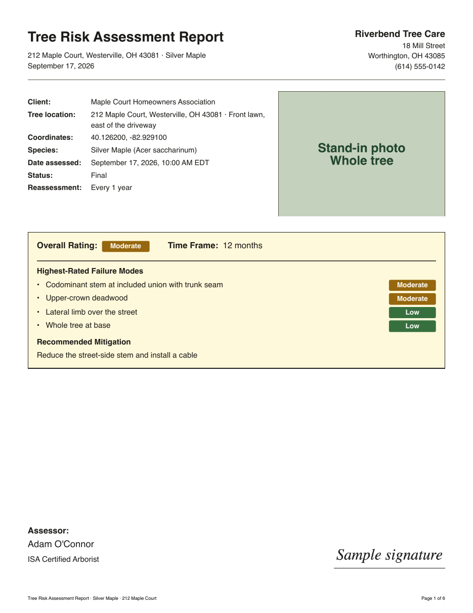
Photo documentation
Every tool on this list lets you attach photos. The differences are in what happens next:
- Are photos kept with the tree, so next year’s assessment can use them?
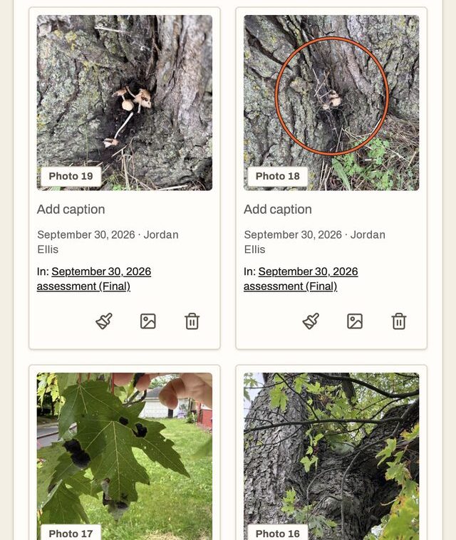
- Can you mark a photo up, circling the decay or adding an arrow to the crack?
- Do the photos in the report have numbers your text can refer to?
I couldn’t find photo markup mentioned by any of the other tools. RootFlare numbers every photo in a tree’s gallery, lets you draw arrows, circles and labels on it, and prints those markings in the report.
Historical records
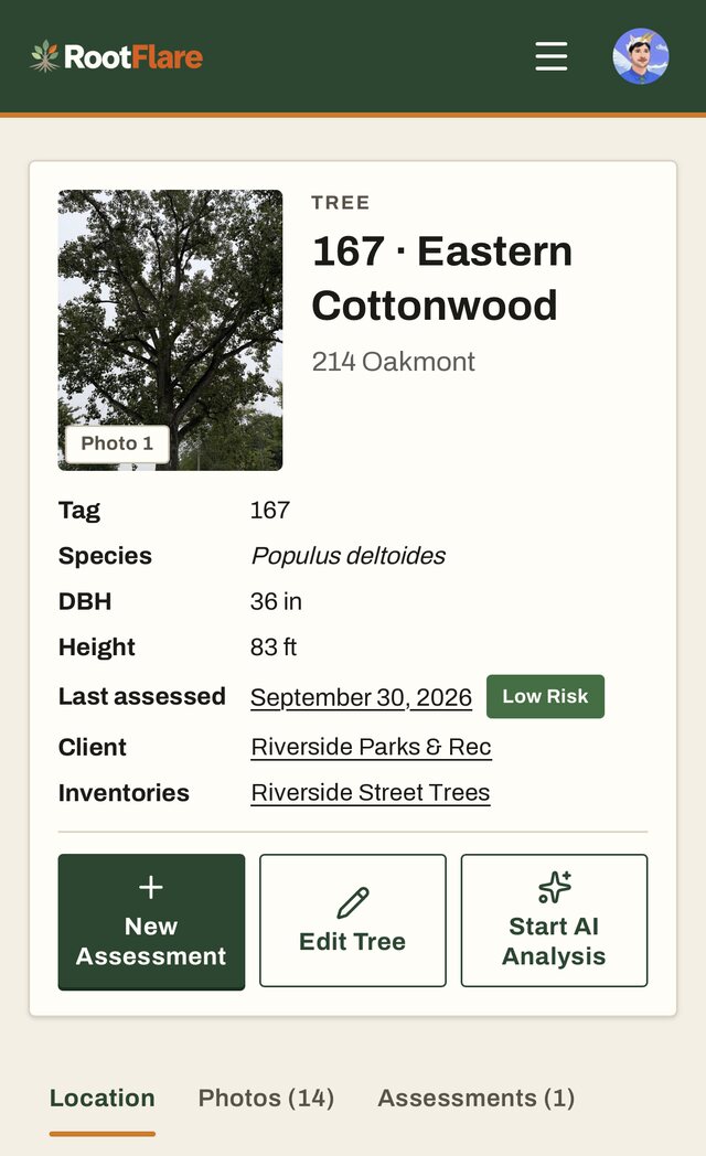
A tree risk assessment is a snapshot. The real value builds up when you can see the same tree over five years. Ask whether the software keeps every past assessment with the tree, or just the latest state.
The CRMs keep a tree’s service and health history, which is useful for a care program but isn’t the same as a risk history. Urban Forest Metrix explicitly keeps each assessment with the tree’s visit history so you can compare risk over time. RootFlare keeps every assessment on the tree’s page, and each new one starts fresh from the tree’s current details, so every visit is judged on what you see that day.
GIS interoperability
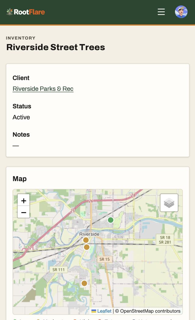
If you work with municipalities or campuses, your data will eventually need to go into somebody’s GIS. Ask what comes in, what goes out, and in what formats.
This is where the GIS platforms are well ahead:
- Fulcrum exports to CSV, Excel, shapefile, Esri file geodatabase, KML, GeoJSON, GeoPackage and more.
- TreeKeeper works with shapefiles and connects to systems like Cityworks and Cartegraph.
- TreePlotter imports shapefiles and integrates with Esri environments.
RootFlare is narrower. It imports a client’s tree list from CSV, Excel or GeoJSON, matches it to trees you already have, and exports to CSV or GeoJSON, which ArcGIS and QGIS both open. If you need shapefiles or a live link into a city’s asset system, a GIS platform will serve you better.
Pricing
Published prices tell you a lot about who a tool is for. Here’s what each company listed in October 2026:
| Software | Built for | Published price |
|---|---|---|
| ArborNote | Tree care businesses | $240 a month for one user, plus $130 per extra user |
| Arborgold | Tree care businesses | From $119 a month, annual contract |
| SingleOps | Tree and landscape businesses | From $200 a month billed annually |
| TreePlotter | Cities and campuses | Quote only |
| TreeKeeper | Cities and campuses | $3,600 or $8,000 a year, unlimited users |
| Urban Forest Metrix | Consulting arborists and cities | $2,699 once, or $449 a quarter |
| Fulcrum | Any field team | $43 per user a month, five users minimum |
| Esri ArcGIS | GIS teams | Quote only |
| RootFlare | Consulting arborists and firms | $49 a month for one arborist |
For a one-person consulting practice, the gap is big. The CRMs cost two to five times as much and still don’t do the risk assessment. A city program, on the other hand, may get far more from a platform with unlimited users and deep GIS links than from a per-person tool.
Data ownership
This is the question nobody asks until they want to leave. Your assessments are professional records. You may need them years from now, whatever software you’re using then.
Read the terms for three things:
- Who owns the data? It should be you, in plain words.
- Can you export all of it yourself, any time?
- What happens when you cancel?
ArborNote’s terms are the clearest I found: you keep ownership, an admin can download your data at any time, and it’s kept for 30 days after a paid account ends. Fulcrum lets you export everything in many formats. For most of the others I couldn’t find a public answer.
To be equally clear about RootFlare: your data is yours. You can download all your trees as CSV or GeoJSON and every report as a PDF. There isn’t yet a one-click export of every assessment’s raw data. That’s on my list, and until it exists, you should know.
Questions to ask in any demo
- Turn on airplane mode, do an assessment, and show me what happens when the signal comes back.
- Show me the report my client gets, and the ISA form, if I need one.
- Who calculates the risk rating, the software or me?
- Show me this tree’s assessments from previous years.
- How do I get my trees into the client’s GIS, and in what format?
- What does it cost for me, all in, for a year?
- If I cancel, how do I take my data with me?
Where RootFlare fits
RootFlare is built for arborists who do tree risk assessments and write the reports: consulting arborists, tree care firms, and teams who look after a lot of trees. It does the assessment, the record and the report. It doesn’t schedule crews or send invoices, and it isn’t a replacement for a city’s asset management system.
If that’s your work, I built it for you, because it’s my work too. If it isn’t, one of the tools above may be a better fit, and I’d rather you find the right one than the wrong one.